
Lower Winnipeg River Basin: An opportunity to improve the health of our waters
The Lower Winnipeg River Basin (LWRB) is where the Canadian Prairies meet the Boreal Forest.
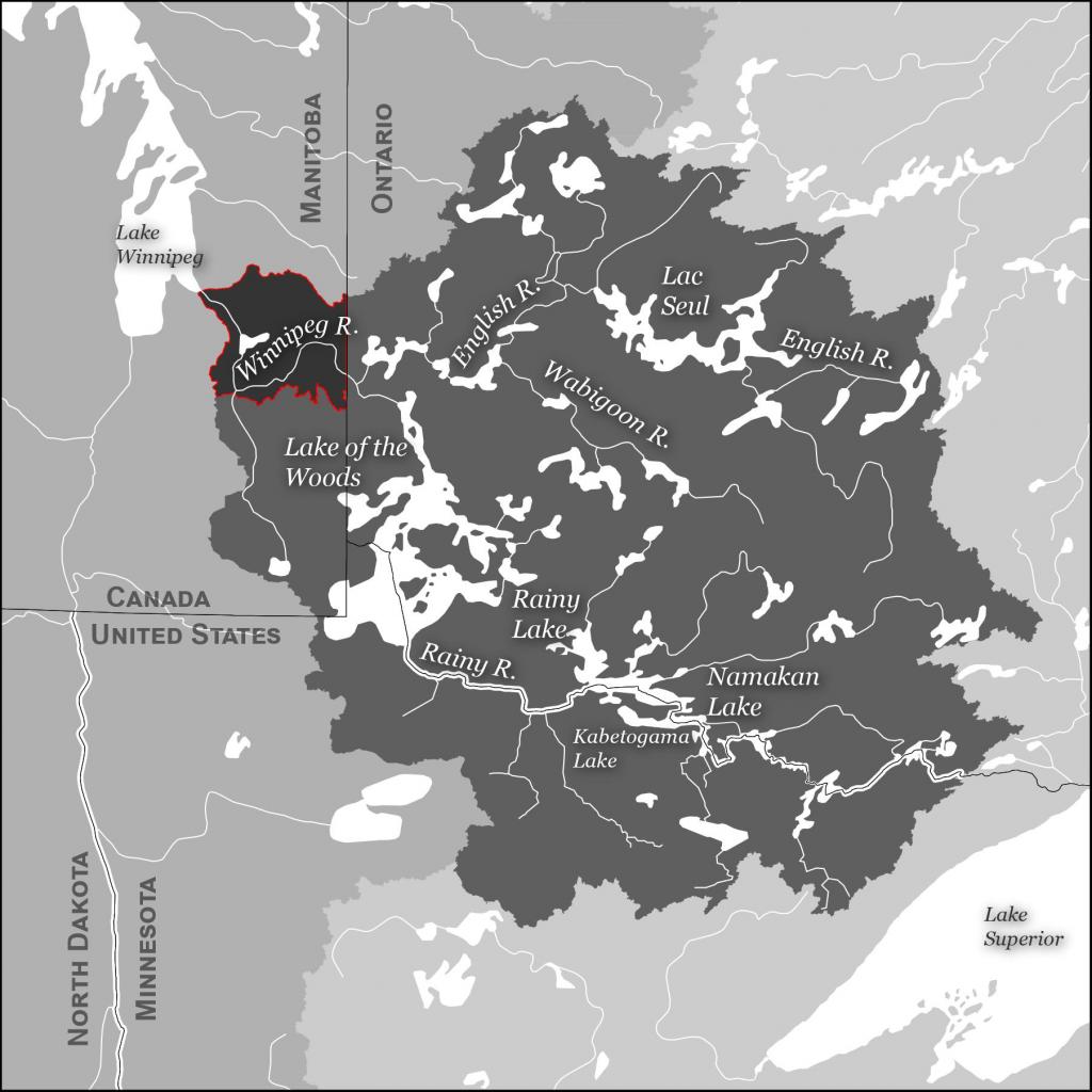
Carrying 50% of the annual flow to Lake Winnipeg, the Winnipeg River snakes through northwestern Ontario, draining Lake of the Woods before reaching Manitoba’s oldest hydroelectric dams, a decommissioned nuclear facility, and thousands of vacation properties. A history of forestry, transportation, mining, and recreation has left a mark on the land and water in this basin.
Did you know that:
- The Winnipeg River reach between Pointe du Bois and Pine Falls contributes approximately 3% of the entire total phosphorus load to Lake Winnipeg?
- The LWRB spans multiple towns and settlements, Whiteshell Provincial Park and supports six hydro generating stations, active mining, and tourism industries?
- There is currently no watershed district established to manage the LWRB and no management plan for the basin?
This presents a unique opportunity to pilot more effective management practices and approaches. IISD has compiled data and information on this section of the basin and is exploring how innovative technologies and Traditional Knowledge can work together to preserve and enhance the health of the water—and the prosperity of the communities on the shorelines.
Want to Learn More?
*Lower Winnipeg River Basin Discussion Sheet Series*
The series below explores multiple aspects of the basin to encourage discussion with experts, government departments, Indigenous groups, and stakeholders.
The series was published in May 2021 and is based on available data collected in 2018 and 2019.
Lower Winnipeg River Basin Discussion Sheet Series Sheet #1 | Climate and Climate Change
This Discussion Sheet Series highlights research on ecological and socio-economic aspects of the lower Winnipeg River Basin to encourage discussion with experts, government departments, Indigenous groups, and stakeholders.
Lower Winnipeg River Basin Discussion Sheet Series Sheet #2 | Landscape Characteristics
This Discussion Sheet Series highlights research on ecological and socio-economic aspects of the lower Winnipeg River basin to encourage discussion with experts, government departments, Indigenous groups, and stakeholders.
Lower Winnipeg River Basin Discussion Sheet Series Sheet #3 | Hydrology: River discharge and level
This Discussion Sheet Series highlights research on ecological and socio-economic aspects of the lower Winnipeg River Basin to encourage discussion with experts, government departments, Indigenous groups, and stakeholders.
Lower Winnipeg River Basin Discussion Sheet Series Sheet #4 | Water Quality and Nutrient Loading
This Discussion Sheet Series highlights research on ecological and socio-economic aspects of the lower Winnipeg River basin to encourage discussion with experts, government departments, Indigenous groups, and stakeholders.
Lower Winnipeg River Basin Discussion Sheet Series Sheet #5 | Aquatic Animals and Habitat
This Discussion Sheet Series highlights research on ecological and socio-economic aspects of the lower Winnipeg River basin to encourage discussion with experts, government departments, Indigenous groups, and stakeholders.
Lower Winnipeg River Basin Discussion Sheet Series Sheet #6 | Aquatic Invasive Species
This Discussion Sheet Series highlights research on ecological and socio-economic aspects of the lower Winnipeg River basin to encourage discussion with experts, government departments, Indigenous groups, and stakeholders.
Lower Winnipeg River Basin Discussion Sheet Series Sheet #7 | Communities and Demographics
This Discussion Sheet Series highlights research on ecological and socio-economic aspects of the lower Winnipeg River basin to encourage discussion with experts, government departments, Indigenous groups, and stakeholders.
Lower Winnipeg River Basin Discussion Sheet Series Sheet #8 | History
This Discussion Sheet Series highlights research on ecological and socio-economic aspects of the lower Winnipeg River basin to encourage discussion with experts, government departments, Indigenous groups, and stakeholders.
Lower Winnipeg River Basin Discussion Sheet Series Sheet #9 | Land Management
This Discussion Sheet Series highlights research on ecological and socio-economic aspects of the lower Winnipeg River basin to encourage discussion with experts, government departments, Indigenous groups, and stakeholders.
Lower Winnipeg River Basin Discussion Sheet Series Sheet #10 | Industries and Economic Activity
This Discussion Sheet Series highlights research on ecological and socio-economic aspects of the lower Winnipeg River basin to encourage discussion with experts, government departments, Indigenous groups, and stakeholders.
Lower Winnipeg River Basin Discussion Sheet Series Sheet #11 | Maps
This Discussion Sheet Series highlights research on ecological and socio-economic aspects of the lower Winnipeg River basin to encourage discussion with experts, government departments, Indigenous groups, and stakeholders.


Funded by
You might also be interested in
Prairie Watershed Analytics
Prairie Watershed Analytics is focused on providing Canadians in the Prairies with the information they need to understand their local watershed. Watershed models can support local decision-makers and businesses with evaluating ecosystem services and connecting with environmental incentive programs. Prairie Watershed Analytics is making this practice simple and accessible using open data and toolsto automate and scale watershed modeling tailored to the Prairies.
Scientists from Two Continents Working Together to Improve the Health of the African Great Lakes
World-class scientists and researchers from across North America and Africa are putting their heads together to tackle some of the most pressing issues facing the African Great Lakes today.
AquaHacking Lake Winnipeg
We are challenging young innovators to team up and develop new and innovative solutions to tackle urgent freshwater issues.
Financial Technologies and the Environment
Exploring how financial technologies could help solve pressing environmental challenges.